
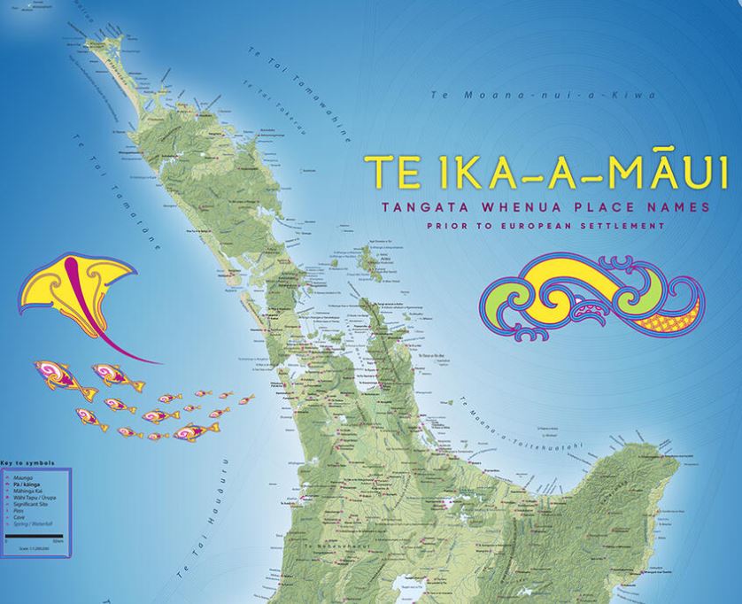

The New Zealand Geographic Board has released updated tangata whenua place name maps, the first update since 1995.
These maps showcase Māori and Moriori place names as they existed prior to European settlement. Divided into two maps for Te Ika a Māui and Te Waipounamu, each map features approximately 900 names, ranging from Te Rerenga Wairua to Rakiura, encompassing mountains, pā sites, sacred places, and food-gathering areas.
The names were sourced from various iwi and hapū groups, as well as the unpublished 1940s centennial atlas compiled by Sir Āpirana Ngata. The board collaborated closely with iwi groups to collect information and stories related to each name. Iwi had the final say in determining which names were included.
The maps aim to represent Aotearoa as it was in 1840 before significant European migration.
The release of these maps aligns with the growing efforts to pronounce Māori place names correctly and encourages the use of Te Reo Māori. The maps will be distributed to schools, marae, and iwi organizations, supporting the new Aotearoa History curriculum. They will also be available for purchase and download through the Land Information New Zealand website.